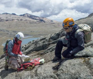
This article profiles ten major European mountaineering destinations. Each entry lists location, highest peaks, standard routes and grades, optimal seasons, access points, permitting rules, hazards, history, and usage statistics, with authoritative sources.
1. Mont Blanc (France / Italy)
Mont Blanc is the highest mountain in the Alps and Western Europe. It straddles the France-Italy border near Chamonix (FR) and Courmayeur (IT). The two main normal routes are via the Goûter Hut (French side, Grand Couloir) and via the Three Monts (from Aiguille du Midi). The standard Goûter Route is graded about UIAA PD (Alpine F); the Three-Monts route via Italy is slightly more technical (AD). Best climbing season is mid-summer (July to August), when snow conditions are stable. Mont Blanc attracts ~30,000 climbers a year, so it can be crowded (peak season is August). Recent safety rules limit guided parties to 214/day and require hut reservations. Hazards include high altitude (acute mountain sickness), weather changes, and especially rockfall in the Grand Couloir, nicknamed the “corridor of death”. First ascended on 8 August 1786 by Jacques Balmat and Michel Paccard, it was the dawn of alpine mountaineering. No special permit is required, but climbers must have a guide or proof of qualification and a booked refuge.
- Elevation: 4,808 m (Mont Blanc summit)
- Main Routes: Goûter Hut (F/PD glacier climb); Trois Monts (AD ice/rock traverse)
- Grade: Alpine PD (Goûter) to AD (Trois Monts)
- Season: July to August (early season snow); high crowds in August
- Access: Chamonix (FR) or Courmayeur (IT) via cable car/lift
- Permits: Guide booking and hut reservation required (quota limits)
- Hazards: Altitude, rockfall (Grand Couloir), crevasses, sudden weather
- Experience: High-altitude glacier travel; recommended experienced with crampons/ice axe
- Guides/Clubs: Compagnie des Guides de Chamonix, CAF, UIAA-member clubs.
- First Ascent: 8 Aug 1786 (Balmat & Paccard)
2. Matterhorn (Switzerland / Italy)
The Matterhorn (4,478 m) in the Pennine Alps is famous for its steep pyramidal peak. Its standard ascent is via the Hörnli Ridge (Swiss side); this route involves snow/ice and UIAA III rock, overall graded AD (Assez Difficile). The Italian Lion Ridge is similar. Other classic routes include the Italian Duca degli Abruzzi (ED, very hard) and the Hörnli-Nordwand, Nordwandstich (ED). The normal route is climbed mainly July to August, when the lower ridges are often snow-free. Access is by mountain railway to Hörnli Hut (3,260 m) from Zermatt.
- Elevation: 4,478 m
- Main Route: Hörnli Ridge (AD/III rock); Italian Lion Ridge (AD)
- Grade: UIAA AD (peak rock up to III)
- Season: July to early September (dry rock in late summer)
- Access: Zermatt (Switzerland) via cable-car to Schwarzsee (Hörnli Hut)
- Permits: None (Swiss border formalities only)
- Hazards: Extreme rockfall; loose rock and cornices; many fatalities (≥ 500)
- Experience: Alpine rock climbing; recommended advanced climbers with technical skills
- Guides/Clubs: Zermatt/Gornergrat guides, Alpine Club member organizations (e.g., SAC)
- First Ascent: 14 July 1865 by Edward Whymper (descent accident killed 4)
3. Eiger (Switzerland)
The Eiger (3,970 m) lies in the Bernese Alps near Grindelwald. Its Mittellegi Ridge (East Ridge) is the easiest ascent (UIAA AD, rock up to III); many climbers do the Eiger via Jungfraujoch, then up via north-east (Mittellegi) or the south ridge. The infamous North Face (“Mordwand”) was first climbed in 1938 and is rated ED2/ED3. Best conditions are mid-summer (late Aug) when rock is dry.
- Elevation: 3,970 m
- Main Route: Mittellegi Ridge (AD, UIAA III); North Face (ED)
- Grade: AD (normal); ED (north face)
- Season: Late July to Sept (best August to Sept for north face)
- Access: Jungfraujoch train (via Grindelwald/Wengen); approach from Eigergletscher station
- Permits: None
- Hazards: Steep rock; ice and seracs on north face; many historical climbing accidents.
- Experience: For Mittellegi ridge – solid alpine experience; North Face requires expert ice/rock climbing.
- Guides/Clubs: Grindelwald guide service (and Swiss Alpine Club SAC)
- First Ascent (North Face): 24 July 1938 by Heckmair et al (legendary “last of the big three faces”)
4. Monte Rosa Massif (Switzerland / Italy)
The Monte Rosa massif (Valais/Val d’Aosta) contains multiple 4,000m peaks, including Dufourspitze (4,634 m, Switzerland’s highest). Standard ascents are from the Italian side via huts (e.g. Margherita Hut, Gnifetti Hut) or Swiss side (Monte Rosa Hut near Zermatt). Routes involve glacier travel and easy rock. The normal Dufourspitze route is mostly PD/PD+ (F+).
- Elevation: 4,634 m (Dufourspitze)
- Main Routes: Glaciers via Capanna Margherita/Refuge Gnifetti (IT) or Monte Rosa Hut (CH)
- Grade: UIAA F+ (approx. PD/PD+ overall)
- Season: July to September (warmer snow)
- Access: Zermatt (train to Rotenboden/Monsieur Hut) or Alagna (IT) via lifts to Belvedere
- Permits: None (Monte Rosa Hut run by SAC)
- Hazards: Crevasses, weather; high altitude (acclimatize)
- Experience: Alpine glacier skills; suitable for well-acclimatized climbers
- Guides/Clubs: Swiss Alpine Club (SAC) Hut system; Italian CAI guides.
- First Ascent: 1 Aug 1855 by a British-Italian team (includes Charles Hudson)
5. Gran Paradiso (Italy)
The Gran Paradiso (4,061 m) is the highest peak entirely in Italy. It stands in Graian Alps (Gran Paradiso National Park). It’s widely regarded as the “easiest” Alpine 4000er. Normal climbs start from Rifugio Frédéric Chabod or Vittorio Emanuele II (Vallée d’Aosta). The route is a long glacier walk graded F+ (UIAA) for most of it, with the final ~15 m of summit rock at UIAA I-II. Season runs June to September.
- Elevation: 4,061 m
- Main Routes: From Rifugio Chabod or Vittorio Emanuele II huts (glacier plus easy rock)
- Grade: UIAA F+ (minor scrambling to UIAA II at summit)
- Season: Late June to Sep (parks accessible)
- Access: Pont (Valnontey, Cogne) or Valsavarenche (Cogne); cable car lifts to ~2800 m (Temelini Huts) are available
- Permits: None (inside national park)
- Hazards: Glacial crevasses; late-season rockfall; still high altitude.
- Experience: Beginner 4000er; recommended acclimatization on prior climbs.
- Guides/Clubs: Gran Paradiso National Park; Italian Alpine Club CAI guides.
- First Ascent: 4 Sep 1860 by J. Cowell, W. Dundas et al.
6. Dolomites (Italy)
The Dolomites (northern Italy) are a world-famous climbing region with ~18 peaks over 3,000 m. The highest is Marmolada (3,343 m). Unlike the Alpine 4000ers, Dolomite climbs are mostly rock routes and via ferrata (iron‑fixed) trails. Difficulty varies widely: classic rock routes on the sheer summits range from UIAA PD (easy climbs) up to VI/ED for extreme routes. Popular via ferrata routes (e.g. Alta Via del Sale, Via Ferrata delle Trincee) are often graded PD/AD. Best seasons are summer (July to Sept) when snow is cleared. Access points include Cortina d’Ampezzo, Val Gardena, Belluno. Conservation: many areas are in national parks (Dolomiti Bellunesi NP). Notable history: Italian WWI soldiers first forged many ferrata routes.
- Elevation: Highest ~3,343 m (Marmolada)
- Terrain: Steep dolomite walls; climbing via ferrata and multi-pitch rock routes
- Grade: Rock climbs UIAA from F up through VI/ED; via ferrata F to AD
- Season: July to Sept (summer conditions)
- Access: Ski/tourist centers (Cortina, Bolzano, Madonna di Campiglio) with cable cars to high cols
- Permits: Park regulations in places (Dolomiti Unesco site) but no special alpine permits
- Hazards: Loose rock and rockfall; sudden storms
- Experience: Climbers should be comfortable on exposed rock and via ferrata; helmets essential.
- Clubs: CAI (Italian Alpine Club) and German, Austrian clubs maintain many routes.
7. Großglockner (Austria)
The Großglockner (3,798 m) is Austria’s highest peak and a national symbol. It lies on the Tyrol-Carinthia border in Hohe Tauern National Park. The normal route (via Erzherzog-Johann-Hütte) is a glacier ascent (snow slopes ~35°) with a final rock ridge (UIAA II). Overall grade is PD. Best season is summer (July to Aug); in winter it is a serious mountaineering undertaking. Access is via the toll road to the Franz-Josefs-Höhe (from Heiligenblut or Kals) and trailhead at Lucknerhaus (1,918 m).
- Elevation: 3,798 m
- Main Route: Erzherzog-Johann-Hütte (Adlersruhe) via Pasterze Glacier (PD, UIAA II)
- Grade: UIAA II (PD)
- Season: June to Sept (July is busiest); thousands of summer ascents (~5,000/year)
- Access: Carinthia (Heiligenblut) or Tyrol (Kals am Großglockner); toll road to Franz-Josefs-Höhe
- Permits: None (national park regulations apply)
- Hazards: Crevasses; weather (afternoon storms); long exposure to sun on snow/rock.
- Experience: Fit climbers with glacier and scrambling skills; guided climbs common
- Guides/Clubs: Austrian Alpine Club (ÖAV) maintains Stüdlhütte (2,802 m) and Johann Stüdl Hut.
- First Ascent: 28 July 1800 by Sepp & Martin Klotz et al.
8. Mount Elbrus (Russia)
Mount Elbrus (5,642 m) is the highest mountain in Russia and Europe. A dormant volcano in the Caucasus, it has two summits (west 5,642 m, east 5,621 m). The standard ascent is the South Route, often done in 2 to 3 days using cable cars and huts. This route is non-technical, graded UIAA PD–. Climbing season is mid-summer (July to Aug) when weather is relatively stable. Climbers must carry warm gear for cold storms and acclimatize well.
- Elevation: 5,642 m
- Main Route: South Route (via LeapRus cable car and Barrels/refuges, snow climb)
- Grade: UIAA PD– (basically a glacier walk)
- Season: July to August (long daylight, less wind)
- Access: Mineralnye Vody (air); base town Terskol (north) or Terskol-Azau (south) with cable cars to 3,800 m
- Permits: Russian visa required (special permits for foreign climbers)
- Hazards: Altitude (sore head, pulmonary edema possible); cold weather; crevasses on upper slopes.
- Experience: High-altitude endurance; inexperienced climbers often hire guides.
- Guides/Clubs: Russian tourist agencies; UIAA affiliates like KRSO (Caucasus rescue) manage routes.
- First Ascent: West summit 1874 by F. Crauford Grove’s party; east summit 1829 by Khillar Khashirov.
9. Pico del Teide (Spain)
Pico del Teide (3,715 m) is a volcanic summit on Tenerife (Canary Islands). It is Spain’s highest point and highest volcano in Europe. The normal route (Montaña Blanca to summit crater) is a hike/scramble (UIAA F) and can be done in 1 to 2 days. A cable car goes to 3,555 m to cut the climb. There is no technical climbing. Summer and winter ascents are possible (though snow arrives in winter).
- Elevation: 3,715 m
- Main Route: Hiking trail via Montaña Blanca (F, strenuous); cable car to 3,555 m available
- Grade: UIAA F (walk-up/scramble)
- Season: All year (avoid mid-summer heat); winter snow gear needed if climbing in cold season.
- Access: Teide National Park (requires €27 “Tenerife Card”); trailhead at Parador del Teide (2,100 m); cable car at 2,356 m.
- Permits: Free summit permit required (200 spots/day; needed for sunset/sunrise).
- Hazards: High altitude (cause for dizziness); volcanic fumes (rare); sun exposure.
- Experience: Hikers in good shape; note altitude even though 3.7 km.
- Guides/Clubs: Teide NP rangers and climbing guides; many tour operators.
- Popularity: Teide National Park is Europe’s most-visited (5.24 million in 2024).
- First Ascent: Known to Guanches long ago; first recorded ascent in 1582.
10. Mount Ararat (Turkey)
Mount Ararat (5,137 m) is a massive dormant stratovolcano in eastern Turkey. It is traditionally associated with Noah’s Ark and is Turkey’s highest peak. The normal ascent is a long snow climb (no glacier, mostly walking with crampons) from the Turkish southern side. It is rated around UIAA F–PD (non-technical glacier traverse). Season is summer (July to August). Access is via the town of Doğubayazıt (near Iranian border). Climbing requires special permission from Turkish authorities (typically arranged by local guides).
- Elevation: 5,137 m
- Main Route: South ridge hike (long snow ascent), accessible by truck partway.
- Grade: UIAA F–PD (long high-altitude trek)
- Season: July to August (warmer weather; spring/early summer also possible)
- Access: Doğubayazıt (East Turkey) – road to 3,200 m; Basecamp at 3,200 m on South Slope
- Permits: Turkish government climbing permit (mandatory, often via guide)
- Hazards: Altitude; sudden storms; remote/rescue difficulties.
- Experience: Requires excellent physical condition; often combined with ski-mountaineering descent.
- Guides/Clubs: Local Turkish mountain guides; Iranian routes exist but also require permission.
- First Ascent: 9 Oct 1829 by F. Parrot and K. Abovian.
Comparative Summary
| Destination | Country/Region | Peak Elevation | Normal Route Grade | Access (Nearest Hub) | Annual Popularity (est.) |
|---|---|---|---|---|---|
| Mont Blanc | France/Italy (Alps) | 4,808 m | PD (Glacier) | Chamonix (FR) / Courmayeur (IT) | ~30,000 ascents |
| Matterhorn | Switzerland/Italy (Alps) | 4,478 m | AD (UIAA III) | Zermatt (CH) | High (thousands) – ~500 fatalities historically |
| Eiger (Mittellegi) | Switzerland (Alps) | 3,970 m | AD (UIAA III) | Jungfraujoch (CH) | Iconic peak (north face climbs <100/year) |
| Monte Rosa | Switzerland/Italy | 4,634 m | F+ (PD) | Zermatt (CH) / Alagna (IT) | Popular 4000er (many ascents) |
| Gran Paradiso | Italy (Alps) | 4,061 m | F+ (UIAA F+) | Cogne (AO, IT) | Very popular (often used as intro 4000er) |
| Dolomites (Marm.) | Italy (Dolomites) | 3,343 m (Marmol.) | PD–ED (rock) | Cortina d’Ampezzo (IT) | UNESCO site (millions of tourists) |
| Großglockner | Austria (Alps) | 3,798 m | PD (UIAA II) | Heiligenblut/Kals (AT) | ~5,000 ascents |
| Mount Elbrus | Russia (Caucasus) | 5,642 m | PD– (snow) | Mineralnye Vody (RU) | ~hundreds guided ascents/year |
| Pico del Teide | Spain (Canaries) | 3,715 m | F (scramble) | Tenerife (Spain) | ~5.2 million park visitors |
| Mount Ararat | Turkey/Asia | 5,137 m | F–PD (snow) | Doğubayazıt (TR) | ~dozens of permits/year |
Sources: Authoritative guidebooks, national park and Alpine Club publications, and mountaineering histories were used. Visitor figures come from tourism reports. Conservation status and hazards (rockfall on Mont Blanc, Dolomites landslides) are documented by park and UNESCO sources.